
Outdoor Navigation App with Offline Maps and Forecasts
Outdoor Navigation App with Offline Maps and Forecasts
Reliable offline functionality supporting safe navigation in remote, low-connectivity areas
Accurate real-time GPS tracking and route visualization, even without mobile service
Enhanced usability through terrain-aware UI and advanced map overlays
Smooth performance across different devices and conditions, ensuring user trust in the field
About the Project
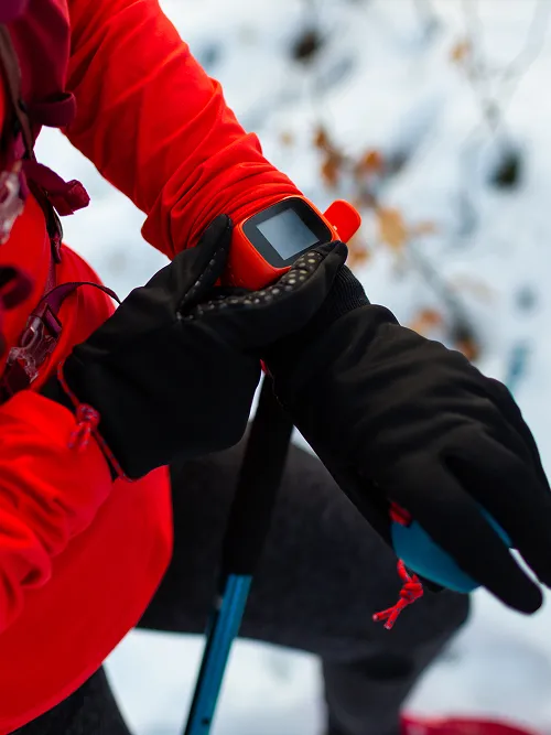
To support navigation in remote areas without internet access, we contributed to the development of iOS and Android mobile applications for hikers and outdoor adventurers.
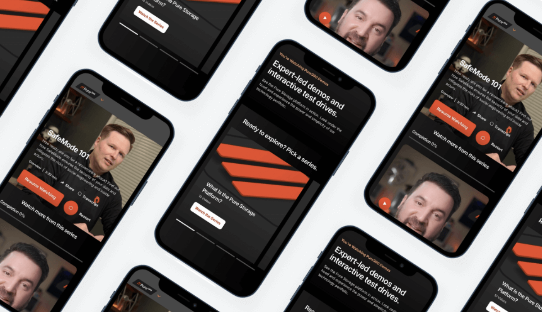
The app integrates multiple map providers, supports offline functionality, and offers advanced features like real-time GPS tracking, terrain overlays, and weather forecast visualizations.
Description
Business Challenge
The client needed a reliable navigation app for outdoor use that would work seamlessly even without internet or mobile coverage. Key challenges included:
- Supporting offline maps with multiple map provider integrations
- Ensuring accurate GPS tracking and real-time geolocation
- Visualizing weather forecasts and environmental data to help users see wind direction, coverage range, and other directional insights on the map
- Designing an app optimized for long-term field use, with special attention to battery consumption
Contributions
We helped design and deliver a robust mobile navigation appbuilt specifically for use in the outdoors:
Integrated major map providers
Including Google Maps, Apple Maps, and OpenStreetMap
Implemented support for offline usage
To ensure full functionality in remote, low-connectivity environments
Developed forecast features and advanced data visualizations
Including radial overlays (“fans”) to show wind, coverage zones, and other directional data
Built real-time GPS tracking
For accurate positioning during hikes and expeditions
Applied power-saving techniques
To optimize GPS usage and background services, extending battery life during long outdoor trips

Key Expertise
This project demonstrates our deep experience in building mobile tools for real-world use cases:
- Deep knowledge of map SDKs and multi-provider integration (Google, Apple, OpenStreetMap)
- Delivered lightweight, responsive UI and advanced visual features while keeping smooth performance
- Strong focus on battery-efficient design to keep the app running longer.
- Designed the app to perform well offline with graceful handling of poor network coverage
Case Studies
You may also be interested in...


Real Results
Lorem ipsum dolor sit amet, consectetur adipiscing elit. Nunc vulputate libero et velit interdum, ac aliquet odio mattis.
